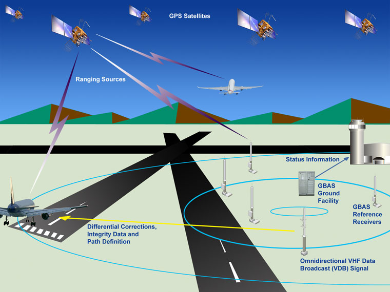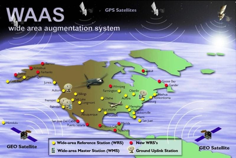
Global Positioning System (GPS)
Global Positioning System (GPS) (formally known as the Navstar Global Positioning System) refers to a space-based radio-navigation system, which is comprised of a constellation of satellites and a network of ground stations. GPS satellites orbit the Earth at an altitude of approximately 11,000 miles. GPS is operated and maintained by the the U.S. Department of Defense. Established by presidential directive, the National Executive Committee for space-based Positioning, Navigation, and Timing (PNT) coordinates GPS-related matters across multiple federal agencies to ensure that the system addresses national priorities as well as military requirements. The National Space-Based Positioning, Navigation, and Timing (PNT) Executive Committee manages GPS, while the U.S. Coast Guard acts as the interface to the public for civil GPS service matters. The FAA Satellite Navigation Team provides GPS-based PNT in the United States to enable performance-based operations for all phases of flight ranging from en route, terminal, approach, to surface navigation. GPS-based PNT services are being examined for the purposes of overcoming the deficiencies in today's air traffic infrastructure and supporting implementation of the Next Generation Air Transportation (NEXTGEN) system for the U.S. National Airspace System (NAS).